
Petra, the legendary capital of the Nabataeans, is one of the most fascinating travel destinations in the world.
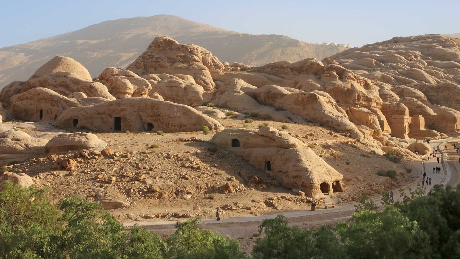
You can wander for days through a breathtaking landscape, discovering more than 600 tombs with stunning rock-cut facades, mysterious burial complexes, cult sites on top of the mountains, enigmatic temples and votive niches along processional pathways, aqueducts and cisterns of an ingeniously conceived water management in the desert. Erected by the Nabataeans more than 2,000 years ago, many of the buildings were expanded during the Roman Empire, or transformed into Byzantine churches or Crusader castles in later times.
This web guide offers you a wealth of in-depth information and curated photo tours, showing highlights, hidden gems, walks and trails - also off the beaten track, while conveying historical, religious and cultural contexts.
Petra, meaning "rock," is the Greek denomination of the ancient capital of the Nabataeans, which they themselves called Raqmu. The origin of the Nabataeans is not clear, they probably came from northern Arabia. A first historical mention appears in connection with the plundering of one of their retreats by Greek troops in 311 BC. The wealth of the Nabataeans, already legendary at that time, resulted primarily from the trade in frankincense and myrrh, as well as the sale of bitumen from the Dead Sea.
At first, Petra/Raqmu served as a seasonal tent camp for the originally nomadic traders and cattle breeders. In the course of the 3rd century BC, a permanent settlement developed, which prospered after being connected to the Incense Road, and became the political and religious center of the Nabataeans.
The wide valley basin of Petra is extremely unsuitable for the construction of a city. Drinking water had to be brought in from springs through kilometer-long pipes. Since the area lies like a funnel in a rocky landscape, complex protective structures against flash floods and heavy rains were essential. And the lack of long-distance visibility made it necessary to build guard posts on the surrounding mountains. However, the place obviously had a special significance for the Nabataeans, which is why their kings had the capital developed at enormous expense into a magnificent metropolis and an international showcase. At one time, an estimated 30,000 people lived there.
With King Aretas IV (9 BC - 40 AD) the heyday of the Nabataeans began. Under him and his two successors most of the more than 600 façade tombs were hewn into the rocks and the other large buildings were constructed. The Nabataean Kingdom lost its independence when the Romans annexed it in 106 AD and transformed it into the Provincia Arabia. Petra remained the most important center of the new province, and under the Roman administration began an extensive program of urbanization, as well as renewal and expansion of existing buildings.
When the decline of Petra had already begun, an earthquake caused severe damage in 363 AD. But the city continued to exist for a while. In the 5th century, several churches were built, one from the converted Urn Tomb and three others from remains of destroyed buildings. By the 7th century, the once large urban settlement had disintegrated into small clusters spread across the valley. The last historical evidence of the site's existence dates back to the 13th century.
With the secret visit of the Swiss Johann Ludwig Burckhardt in 1812 began the modern discovery of Petra, which in 1985 was declared a UNESCO World Heritage Site for its outstanding universal value and unique archaeological treasures.
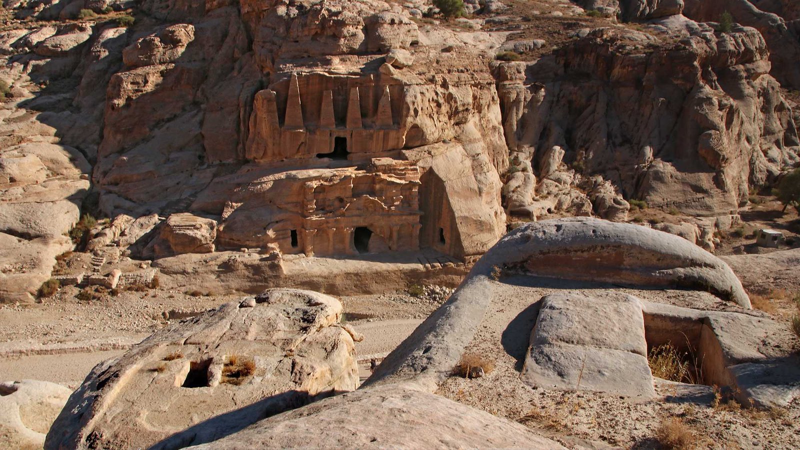
Obelisk Tomb and Bab as-Siq Triclinium. The two very different rock-cut structures were built at the same time (40 - 70 AD) and functionally coordinated. In the foreground, pit graves on a rock.
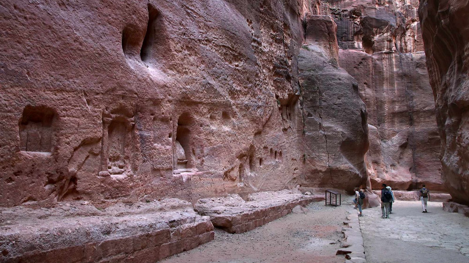
Row of votive niches, some with inscriptions, known as Sabinos Alexandros Station. Along the Siq are many other testimonies of the Nabataean religion, including betyls and small incense altars.
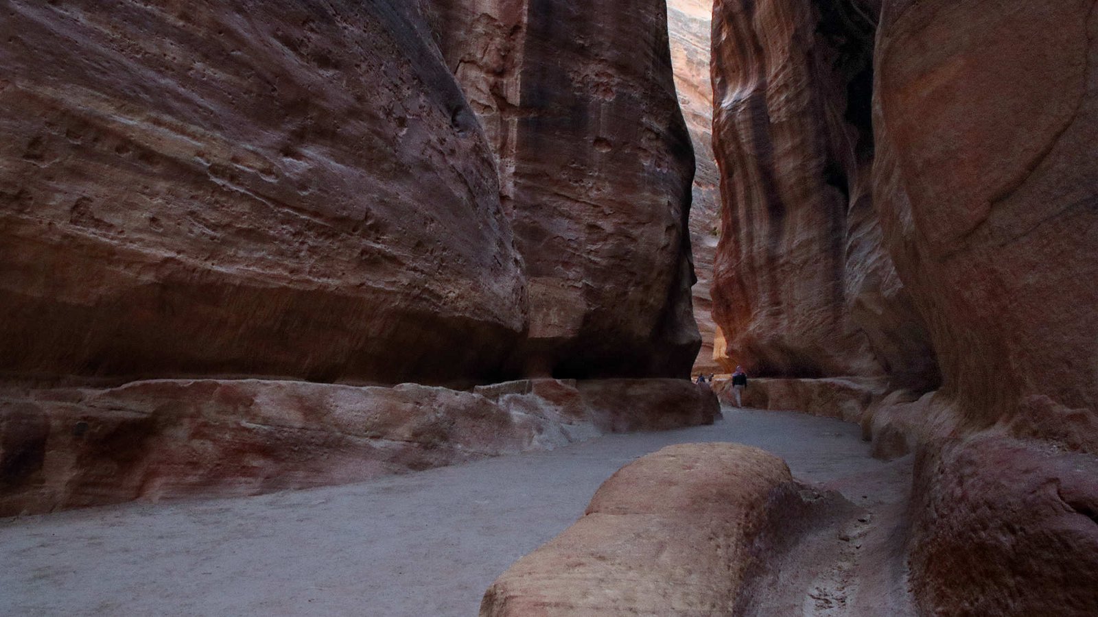
The Siq (shaft), the main pathway to Petra, winds over 1.2 km through a cleft in the sandstone massif which in some places is only 3 m wide and up to 70 m deep. On both sides of the path you can see the remains of Nabataean water channels.
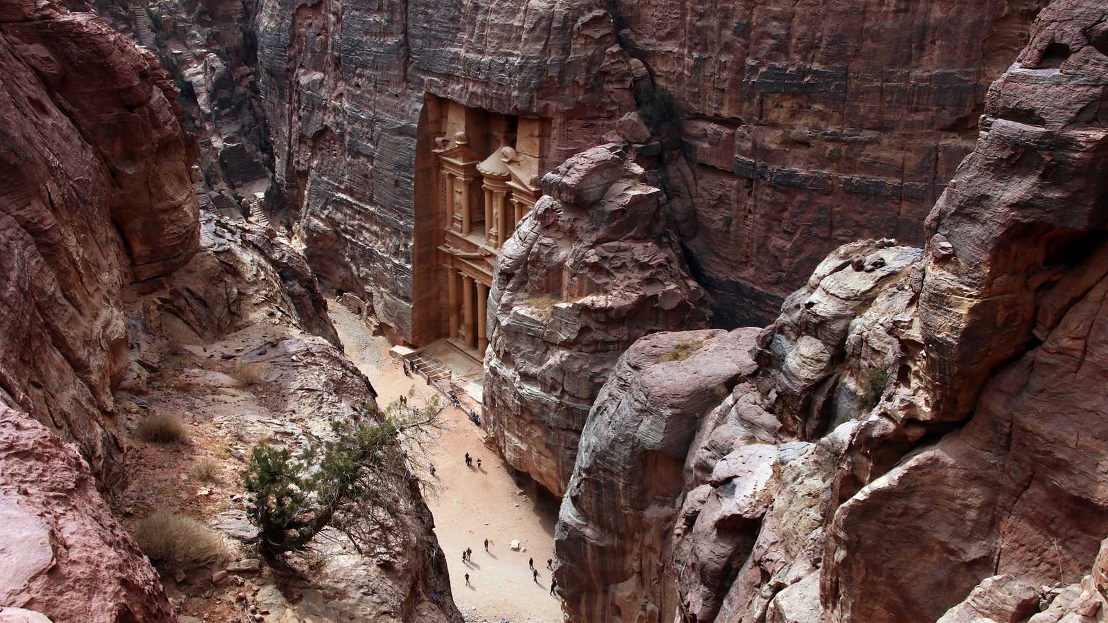
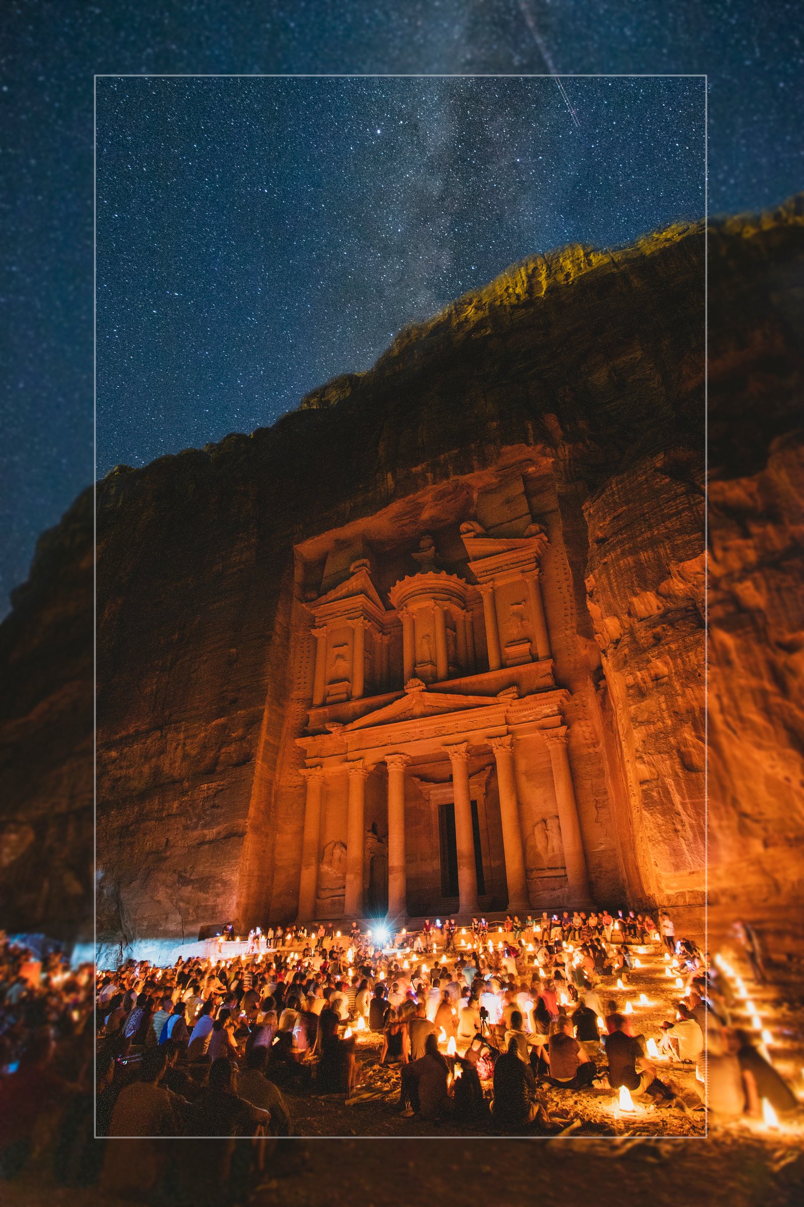
The most famous tomb in Petra. Bedouins called it "Khazneh al-Fira'un" (Pharaoh's Treasury, short: al-Khazneh), because they believed that a fleeing Egyptian pharaoh hid a treasure in the urn on the top.

The 25 m wide and 39 m high al-Khazneh was completely hewn out of the rock probably in the 3rd or 4th decade of our era. The main figure is identified, i.a. by the Basileion on the gable below her as the goddess Isis.
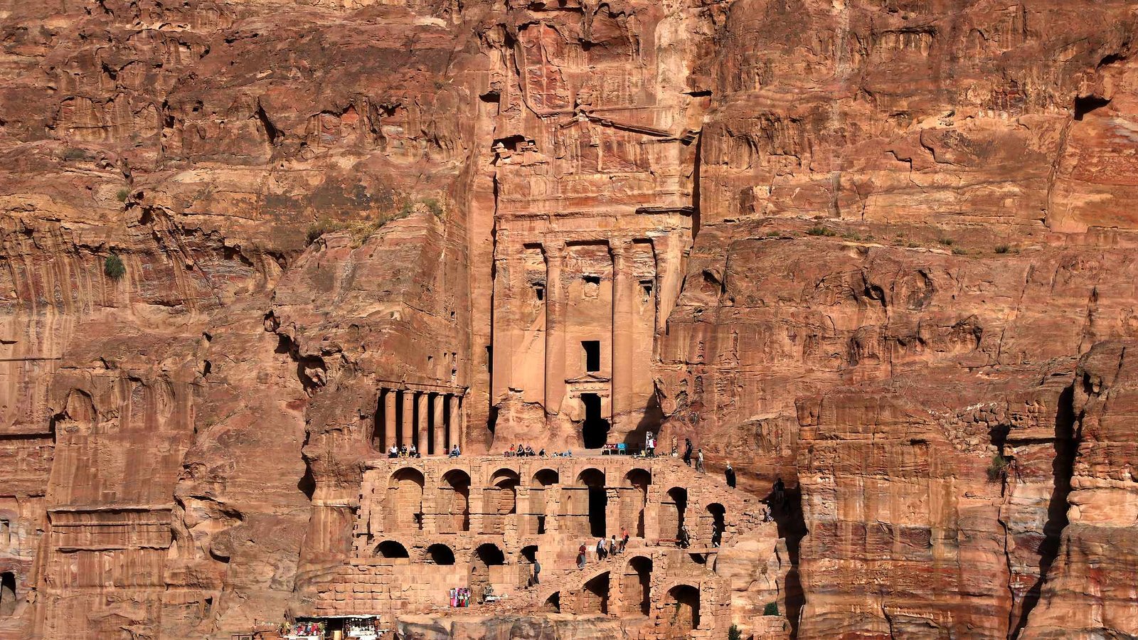
Many facades in Petra were part of larger burial complexes, which could include courtyards, colonnades, banquet rooms, cisterns and basins. Some of these can be seen in the Urn Tomb, which was converted into a church in the 5th century.

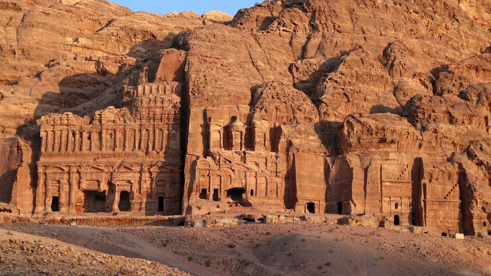
Overlooking the ancient city center, the so-called "Royal Tombs," carved out of the Jabal al-Khubtha rock massif. The elaborately designed, 49 m wide Palace Tomb is one of the largest monuments in Petra.
Source and Reference — Universes in Universe